

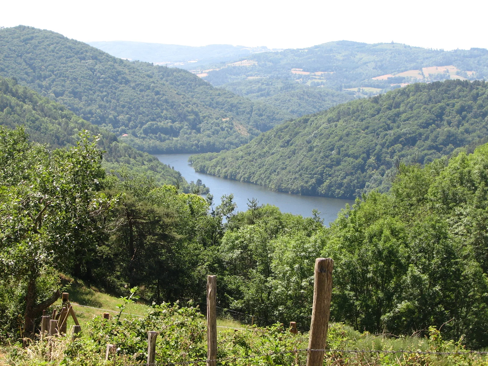
Located on a balcony, Chambles offers views of the gorges but also a remarkable built heritage. Discover some of the small and large monuments of the town!
Route details
Description
Go up towards the D 108 (common route with the GRP des Gorges de la Loire marked in yellow and red). Cross the D 108 and climb Chemin de Peybert. Continue to the right along Chemin du Suc de la Huc. Cross the Biesse road. Continue opposite along Chemin de Saroux.
100 m after the pond, head opposite to enter a Scots pine forest.
Variation: In the pine forest, go down the first path on the right, cross the D32 and continue to Noailleux (11 km circuit – 3 hours).
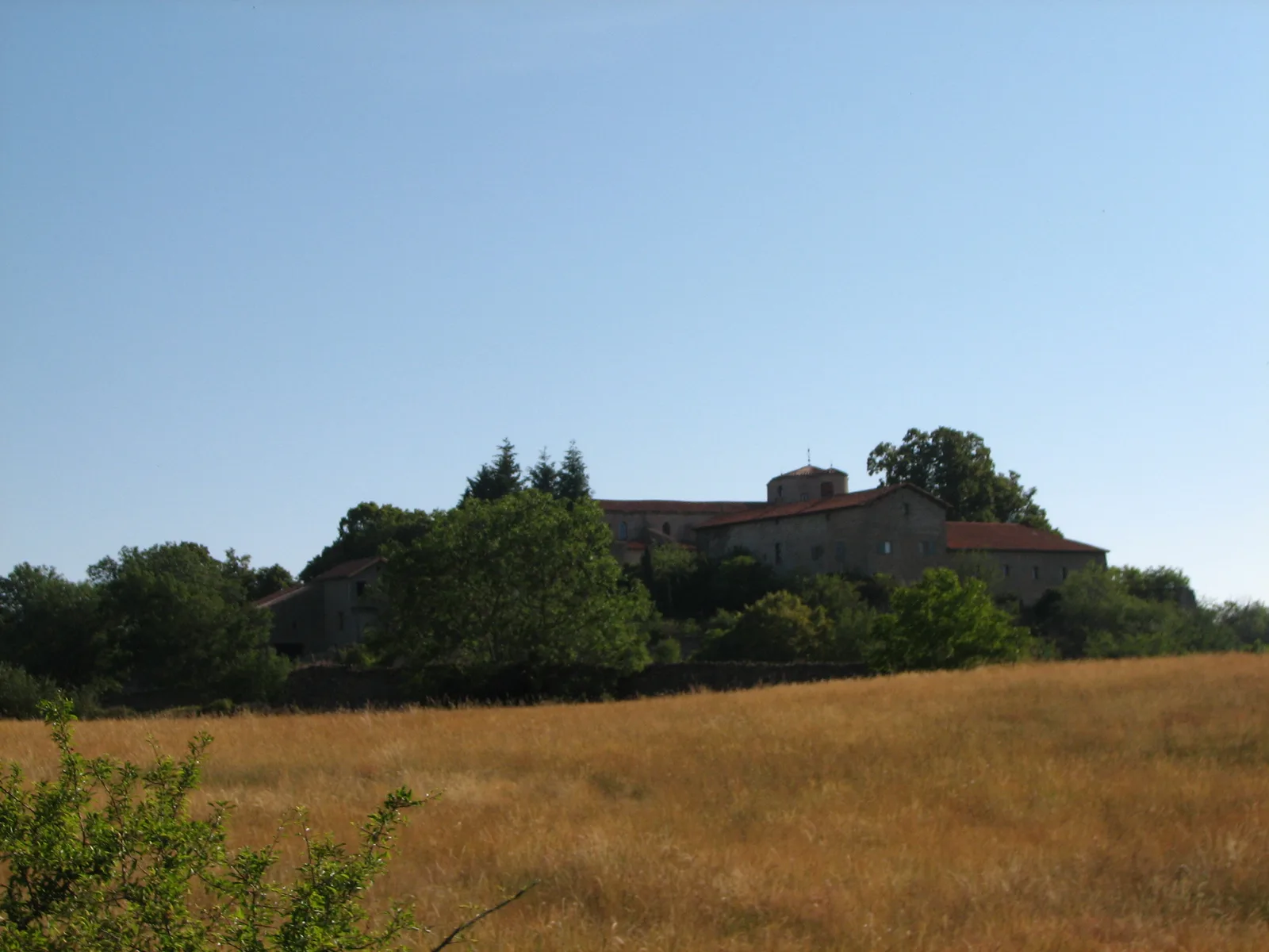
Continue right. At the edge, turn right to cross the D32 and pass through a valley. On the other slope, follow the small road on the right, then climb to Notre-Dame-de-Grâce.
Go down left. Cross another road and continue opposite then to the right, via a path which goes down to the hamlet of Noailleux.
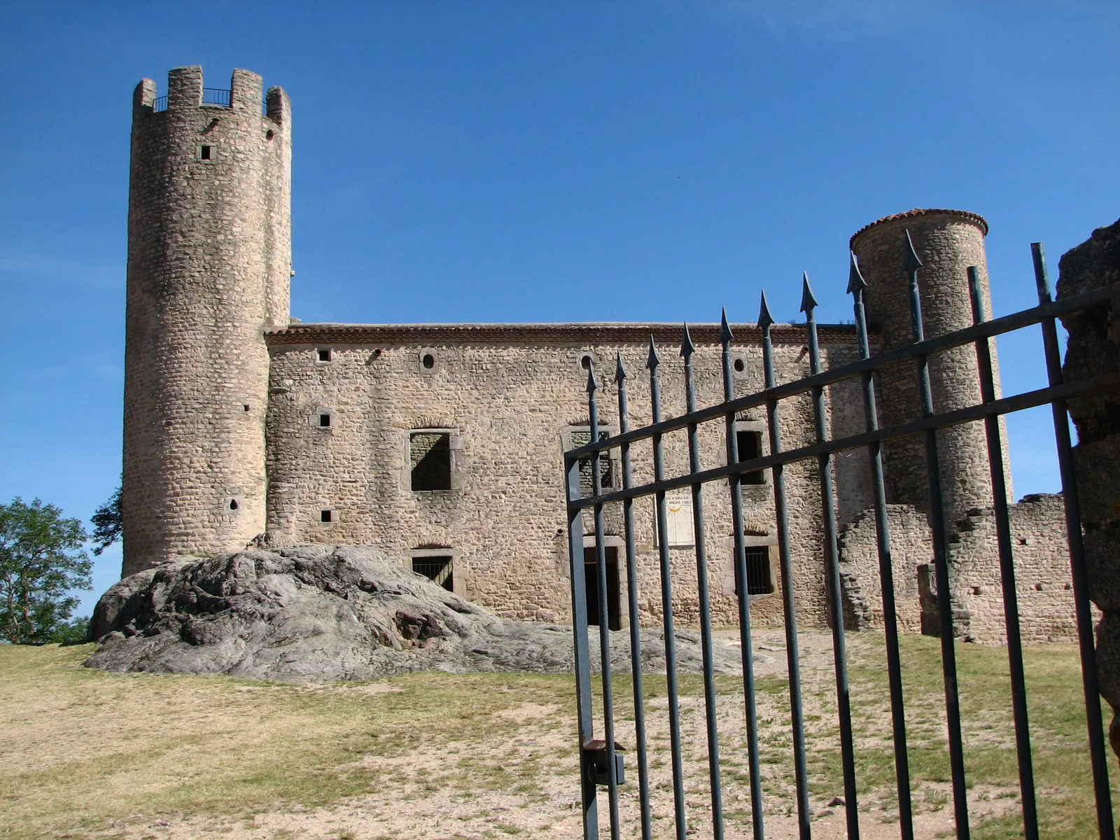
At the cross, go up the road opposite to reach Cessieux (common route with the GRP until the finish? Continue on the road on the left until the D108. Cross the road towards the houses and go down the small road opposite. Cross two streams before climbing a forest path to the Château d'Essalois.
Follow the track to the right. Continue on a small road. At the first intersection, go up the road on the left to reach the Maisons de la Garde. Go down to the left to cross the Garde stream. At a first cross, take the path on the left. At the second, go right towards Chambles. Take Chemin du Cohard on the left to go around the houses.
Access to the peninsula and the Châtelet chapel: go down to the left following the white-yellow markings (50 min round trip, steep slope).
Climb towards the church and the tower by the road, then a stony path.
100 m after the pond, head opposite to enter a Scots pine forest.
Variation: In the pine forest, go down the first path on the right, cross the D32 and continue to Noailleux (11 km circuit – 3 hours).
Continue right. At the edge, turn right to cross the D32 and pass through a valley. On the other slope, follow the small road on the right, then climb to Notre-Dame-de-Grâce.
Go down left. Cross another road and continue opposite then to the right, via a path which goes down to the hamlet of Noailleux.
At the cross, go up the road opposite to reach Cessieux (common route with the GRP until the finish? Continue on the road on the left until the D108. Cross the road towards the houses and go down the small road opposite. Cross two streams before climbing a forest path to the Château d'Essalois.
Follow the track to the right. Continue on a small road. At the first intersection, go up the road on the left to reach the Maisons de la Garde. Go down to the left to cross the Garde stream. At a first cross, take the path on the left. At the second, go right towards Chambles. Take Chemin du Cohard on the left to go around the houses.
Access to the peninsula and the Châtelet chapel: go down to the left following the white-yellow markings (50 min round trip, steep slope).
Climb towards the church and the tower by the road, then a stony path.