

The Malorum, a hill overlooking Bas-en-Basset, was once the setting for very special entertainment on the evening of the summer solstice when the vellaves had the habit of concluding all the weddings planned for the year.
Route details
Description
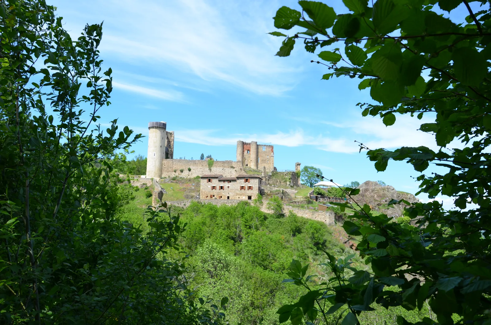
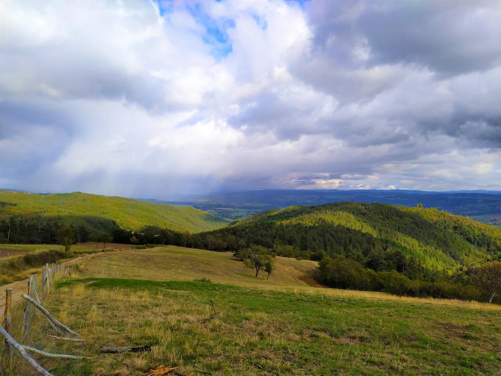
You will pass near the Château de Rochebaron and enjoy, on the ridges, the superb panoramic view of the Loire Valley and the surrounding mountains.
1. Go along the car park on the way up. Opposite the town hall, continue straight on rue Jeanne-d'Arc.
2. Turn right into chemin Saint-Roch and come out on the D 12.
3. Take the D 12 (avenue de la Chomette) on the left. In the bend, continue straight on the small road. It turns into a wide sandy path.
> In the first bend, access to the Devil's Bridge at 200 m.
4. The path rises and reaches Montméat. Cross the hamlet. At the crossroads, at the exit, continue straight.
5. At the first fork, go left for 25 m and, at the next one, continue the
climb on the right. Cross the suc Péchaud and descend towards Thézenac.
Take the D 12 straight on for 50 m.
6. Go right and ignore a path below that turns right. go all
right in the hamlet. At the exit, turn right and begin the descent via
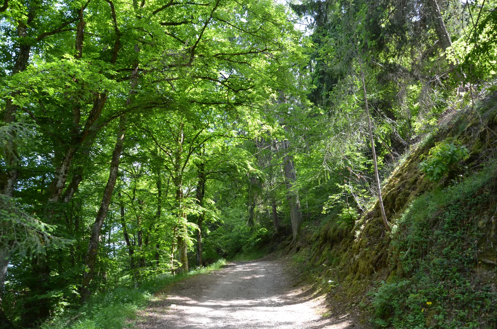
the wide sandy path. Ignore the path on the left, go down and cross the forest for 300 m.
7. Go down the path on the right. It sinks into the wood, meanders then descends the slope (caution!). Cross the Côtes stream and continue on the right bank. Ignore the path going up to the right, continue straight on the side of
hillside and arrive at the foot of Rochebaron castle.
> On the left, access to the castle.
8. Continue on the track on the right. It rises slightly, then descends on the side towards Bas-en-Basset. Pass the chicane, continue straight on the Chemin de Rochebaron and come out on the D 12.
3. By the route used on the outward journey, return to the car park.
UTM coordinates: 31 T 0587135 5017490
1. Go along the car park on the way up. Opposite the town hall, continue straight on rue Jeanne-d'Arc.
2. Turn right into chemin Saint-Roch and come out on the D 12.
3. Take the D 12 (avenue de la Chomette) on the left. In the bend, continue straight on the small road. It turns into a wide sandy path.
> In the first bend, access to the Devil's Bridge at 200 m.
4. The path rises and reaches Montméat. Cross the hamlet. At the crossroads, at the exit, continue straight.
5. At the first fork, go left for 25 m and, at the next one, continue the
climb on the right. Cross the suc Péchaud and descend towards Thézenac.
Take the D 12 straight on for 50 m.
6. Go right and ignore a path below that turns right. go all
right in the hamlet. At the exit, turn right and begin the descent via
the wide sandy path. Ignore the path on the left, go down and cross the forest for 300 m.
7. Go down the path on the right. It sinks into the wood, meanders then descends the slope (caution!). Cross the Côtes stream and continue on the right bank. Ignore the path going up to the right, continue straight on the side of
hillside and arrive at the foot of Rochebaron castle.
> On the left, access to the castle.
8. Continue on the track on the right. It rises slightly, then descends on the side towards Bas-en-Basset. Pass the chicane, continue straight on the Chemin de Rochebaron and come out on the D 12.
3. By the route used on the outward journey, return to the car park.
UTM coordinates: 31 T 0587135 5017490