

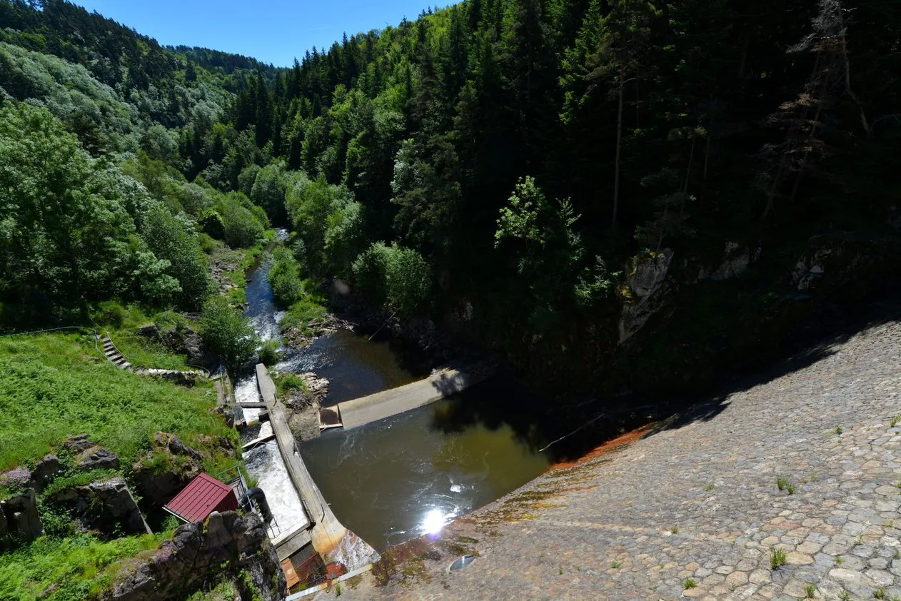
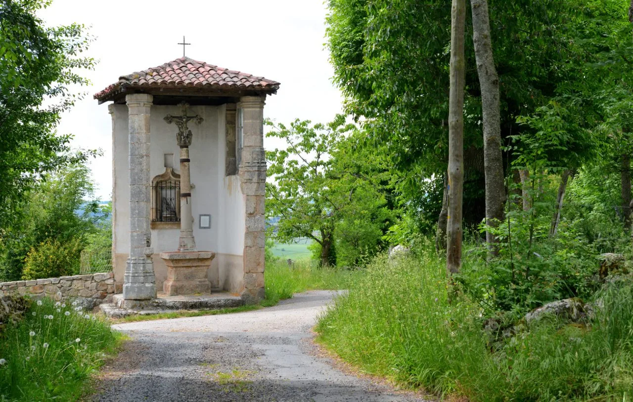
This hike takes you to the Ance gorges. Discover surprising landscapes, the Passouirra dam which supplies the Ance du Nord hydroelectric plant, small heritage sites including the oratory cross of Boisset-Haut.
Sustainable tourism
We promote hiking in Haute-Loire in compliance with the hiker's charter which aims to preserve nature and protected areas.
https://www.rando-hauteloire.fr/
https://www.chemin-rando-hauteloire.fr/?categories=T6&categories=T5
https://www.ffrandonnee.fr/Media/Default/Documents/randonner/charte-du-randonneur-ffrandonnee.pdf
Portrait
The association of the Haute-Loire Hiking Committee has been asserting for 20 years its position in favor of the practice and development of hiking in Haute-Loire. Our business is divided into two major axes of development:
• The tourist and cultural development of the Haute-Loire through hiking
• The associative and sports development of hiking in Haute-Loire
Route details
Description
1. Follow rue Pierre-Savel and, at place Neuve, turn right into rue Pierre-Verrier. Place
Bertrand-de-Chalencon, turn left onto rue des Petites-Écuries; go to
left then right Passage du Château. Turn right on rue Pierre-Verrier.
2. Turn right onto rue du Palais. At the end of it, go left then right towards the school. At the crossroads (tennis courts), turn right then after 50 m turn left.
3. Take the path on the left. It becomes a path and leads to a small
road. Go right then, at the fork, hang left. At the junction,
follow the road on the right towards the Moulin du Sap. In the hamlet, follow the path to the left. In the village of Le Sap, at the cross, turn right. On leaving the village, at the fork, go down to the right for 20 m, then to the left and cross the wood.
Turn right at the edge. At Montzie, cross the road then, in the hamlet, turn right (assembly house). Cross the D 44 to continue on the path opposite.
4. At the crossroads, go down to the left, cross the footbridge over the stream and go up to L'Herm. In the hamlet, keep to the right. Turn right towards the dam. On the descent, the path splits; take twice to the left then, at the edge of the wood, to the right.
5. At the Passouira dam, climb the path on the left then the path on the left. When the main path splits, go left. At T,
turn right and reach Chaumont. In the hamlet, keep left and follow the road for 450 m.
6. Take the path to the right, then the path to the left. Take the D 44 to
left for 200 m. Take the path to the right. At Boisset-Bas, take
the road on the left for 75 m and the street on the right which becomes a path. Continue with
the road. In the center of Boisset-Haut, turn right and, at the cross, right. To use
the road to the left for 50 m. Take the path to the left. stay on the path
major. Follow the road to the left, enter Méalet on the left. After the cross,
take the path on the left.
7. Take the path on the right. At the wider path, go left. After the
laundry, go up rue Joannès-Duffieux to the right and return to the start.
UTM coordinates: 31 T 0574967 5023050