

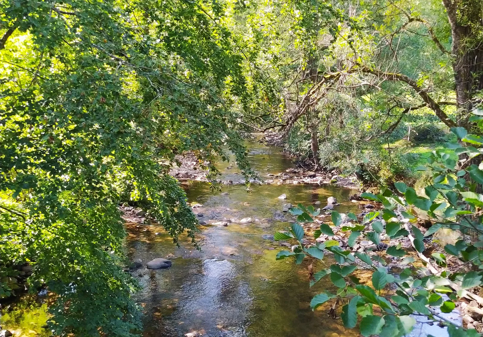
Discover the legends of the elves in unspoiled nature then, in the monastic silence of Saint-Julien, listen to the lapping of the water from the Dunière inviting you to daydream and meditate.
Route details
Description
1. From the village hall, walk along the sports ground and the Early Childhood centre.
Go down rue du Pontonnet to the right. After the Eco-Point, follow the road to Lachamp. Turn right (common section with the PR293 for 300 m), keep right, pass in front of the well and reach the village of Flaminges.
2. At the iron cross, turn right on the D 44 for 50 m then cross the D 500
(caution !). Engage in front. At the crossroads, turn left to reach the center of the village of Jourdy. Slant left. Go down the road to the stream and up the path on the left. Cross the road at Bel-Air and drive 500 m.
3. At the crossroads, turn right (view over the valley). Join the road and the
turn left towards Villedemont.
4. Go straight past the cross then, at the La France intersection, turn left to enter the Laval descent. Cross the village (view of the small bridge and La Dunière) and go up the shady path to the right until
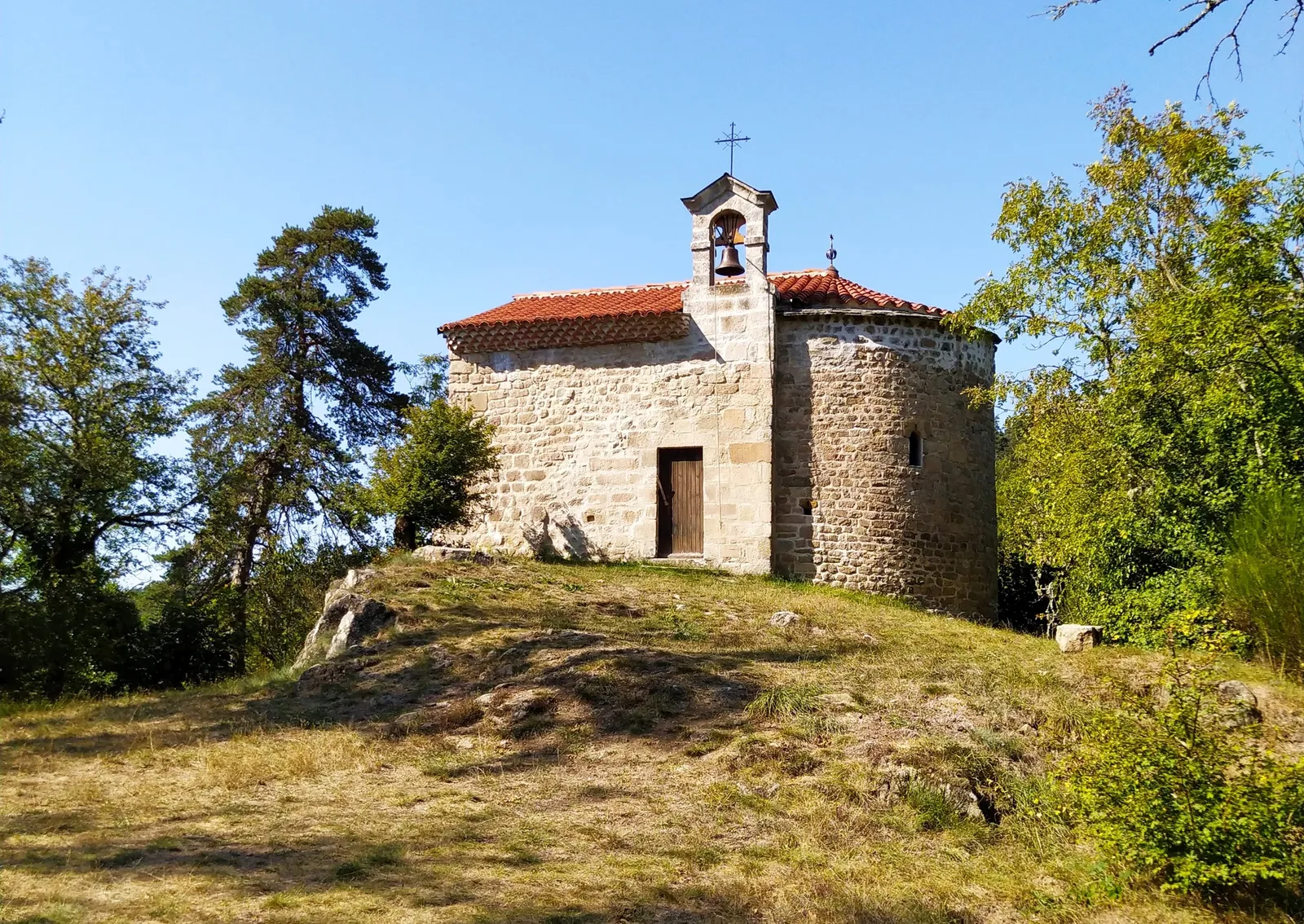
the junction of the Saint-Julien-la-Tourette chapel (located 250 m
left).
5. Turn right, walk along the ruin and continue the ascent. At the fork, turn left to the ruin of La Rinelle. Keep right and go up. On the flat, go down to the left, cross the small wooden bridge and reach the top of the hill.
6. Veer right. Go down the path in the middle of the fields and cross the stream. Before the farm, take the path on the left to Culpéroux.
7. Turn right then, in front of the houses, go up the path on the left. Follow it for 1 km.
8. At the road, turn left for 20 m, then right to reach Le Bouchat. Turn right, go down and cross the D 500 (be careful!). Go up rue de Barthou for 100 m. On the right, take the “chareyron” (narrow passage). Pass in front of the retirement home and reach, through the village, the village hall.
To discover along the way: View of the Mons suc. Chapel of Saint Julien la Tourette. Gorges of the Dunière. Saint Pal de Mons: church.
UTM coordinates: 31 T 0600017 5010945
Go down rue du Pontonnet to the right. After the Eco-Point, follow the road to Lachamp. Turn right (common section with the PR293 for 300 m), keep right, pass in front of the well and reach the village of Flaminges.
2. At the iron cross, turn right on the D 44 for 50 m then cross the D 500
(caution !). Engage in front. At the crossroads, turn left to reach the center of the village of Jourdy. Slant left. Go down the road to the stream and up the path on the left. Cross the road at Bel-Air and drive 500 m.
3. At the crossroads, turn right (view over the valley). Join the road and the
turn left towards Villedemont.
4. Go straight past the cross then, at the La France intersection, turn left to enter the Laval descent. Cross the village (view of the small bridge and La Dunière) and go up the shady path to the right until
the junction of the Saint-Julien-la-Tourette chapel (located 250 m
left).
5. Turn right, walk along the ruin and continue the ascent. At the fork, turn left to the ruin of La Rinelle. Keep right and go up. On the flat, go down to the left, cross the small wooden bridge and reach the top of the hill.
6. Veer right. Go down the path in the middle of the fields and cross the stream. Before the farm, take the path on the left to Culpéroux.
7. Turn right then, in front of the houses, go up the path on the left. Follow it for 1 km.
8. At the road, turn left for 20 m, then right to reach Le Bouchat. Turn right, go down and cross the D 500 (be careful!). Go up rue de Barthou for 100 m. On the right, take the “chareyron” (narrow passage). Pass in front of the retirement home and reach, through the village, the village hall.
To discover along the way: View of the Mons suc. Chapel of Saint Julien la Tourette. Gorges of the Dunière. Saint Pal de Mons: church.
UTM coordinates: 31 T 0600017 5010945