

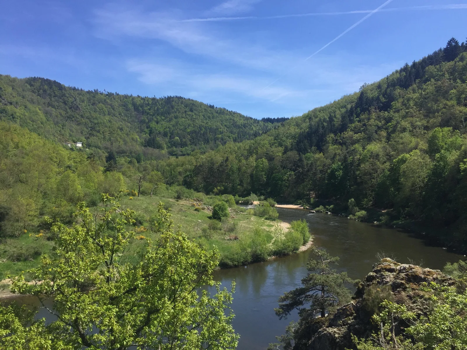
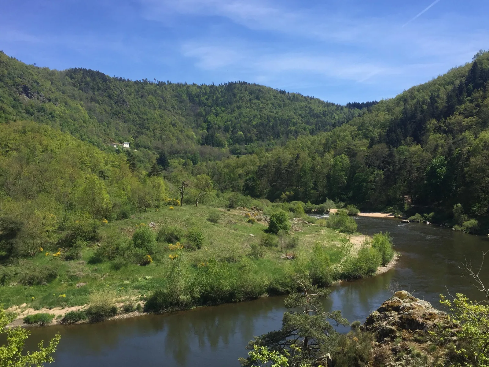
Walk along the banks of the Loire to the Saut du Chien rock, then take the now famous footbridge over the river!
Route details
Alert
Steep climb after the footbridges
Description
From the starting panel, under the footbridge, pass under it to enter the Respirando area. Follow the path that passes between the play areas. Continue straight on the banks of the Loire.
Use the footbridge to cross the stream, then turn left to continue on the bank of the Loire. The path that has become a path leads to a tarmac area. Cross over to take the leftmost path.
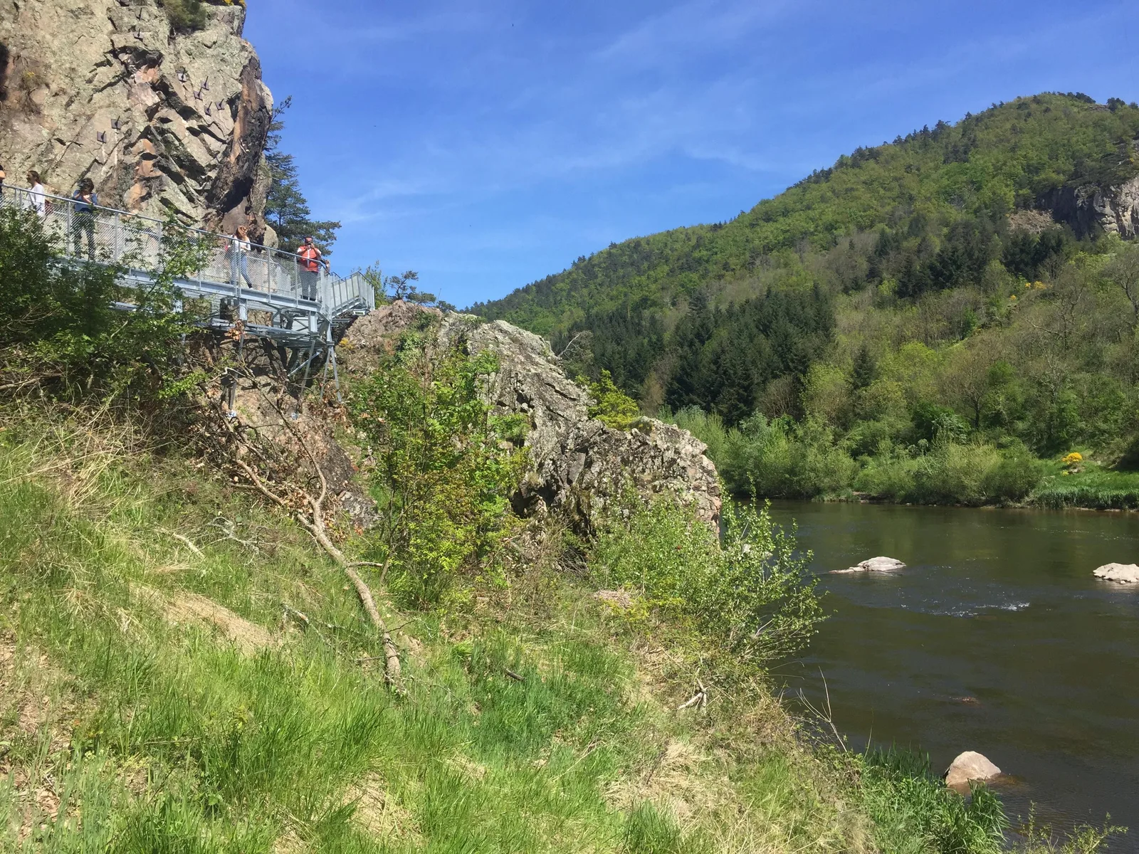
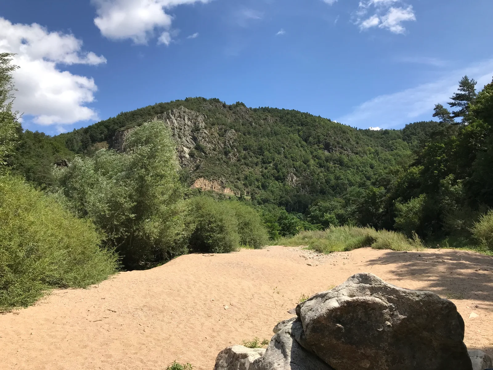
The path reaches the Saut du Chien rocks.
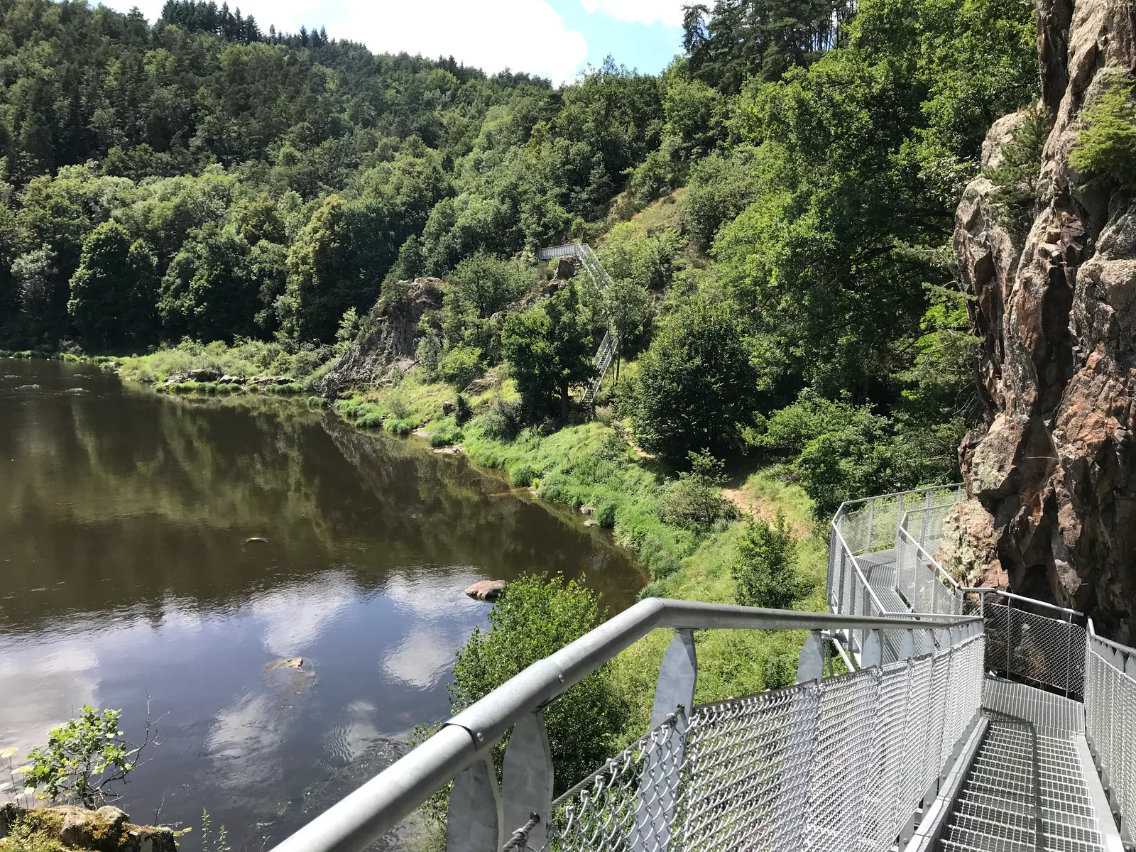
Take the metal stairs then the footbridge to pass this “Saut du Chien”, then follow the path which descends to the edge of the Loire.
After the beach, find a wider route which soon begins to climb.
After the steep path, the path joins the D 46 road.
Cross (be careful!) to find the path on the other side of the road.
At the fork, leave the GR® de Pays, climb left to turn right towards the houses. At the perpendicular road, go left. Go up in the Hermet keeping to the left at the junctions. Leaving the village reach a road.
Cross it to take the path opposite that climbs between the meadows. At the high point, the path splits.
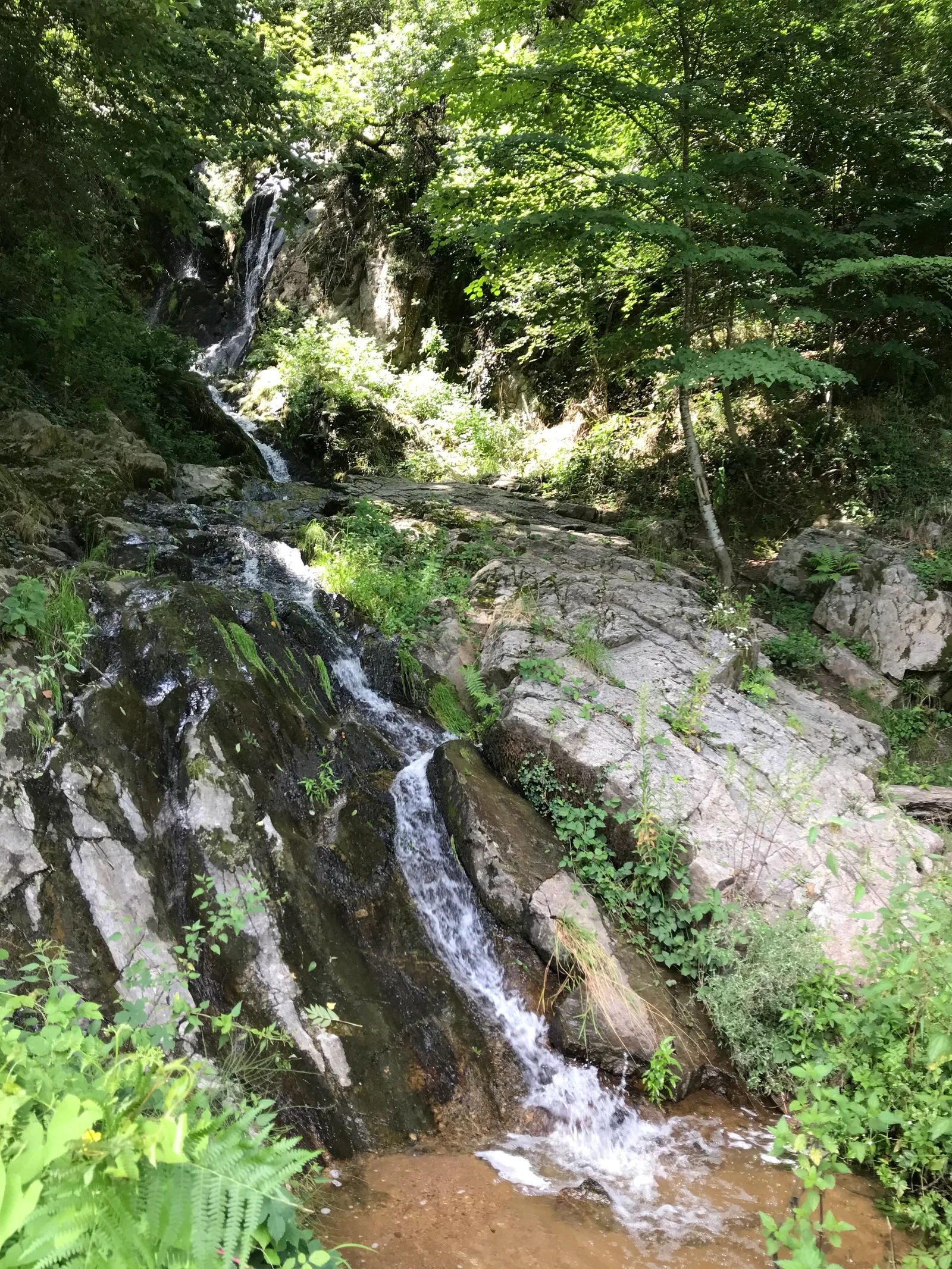
Turn at an acute angle to the right. The wide dirt road descends to a horse farm. Just before the latter, turn left to take the path that plunges into the valley. Pass the ru then come out in the bend of a path. Follow it to the right and reach the first houses of Aurec-sur-Loire. Go down the paved road called Chemin de Bret and cross at the roundabout to follow rue de la Rivière.
Before the swimming pool, go down the lane on the right and find the banks of the Loire. Go left to return to the Respirando area then to the starting point
(possibility to take, in return, the pedestrian footbridge above the Loire).
Use the footbridge to cross the stream, then turn left to continue on the bank of the Loire. The path that has become a path leads to a tarmac area. Cross over to take the leftmost path.
The path reaches the Saut du Chien rocks.
Take the metal stairs then the footbridge to pass this “Saut du Chien”, then follow the path which descends to the edge of the Loire.
After the beach, find a wider route which soon begins to climb.
After the steep path, the path joins the D 46 road.
Cross (be careful!) to find the path on the other side of the road.
At the fork, leave the GR® de Pays, climb left to turn right towards the houses. At the perpendicular road, go left. Go up in the Hermet keeping to the left at the junctions. Leaving the village reach a road.
Cross it to take the path opposite that climbs between the meadows. At the high point, the path splits.
Turn at an acute angle to the right. The wide dirt road descends to a horse farm. Just before the latter, turn left to take the path that plunges into the valley. Pass the ru then come out in the bend of a path. Follow it to the right and reach the first houses of Aurec-sur-Loire. Go down the paved road called Chemin de Bret and cross at the roundabout to follow rue de la Rivière.
Before the swimming pool, go down the lane on the right and find the banks of the Loire. Go left to return to the Respirando area then to the starting point
(possibility to take, in return, the pedestrian footbridge above the Loire).