

PR 679 – Le circuit des Planchettes
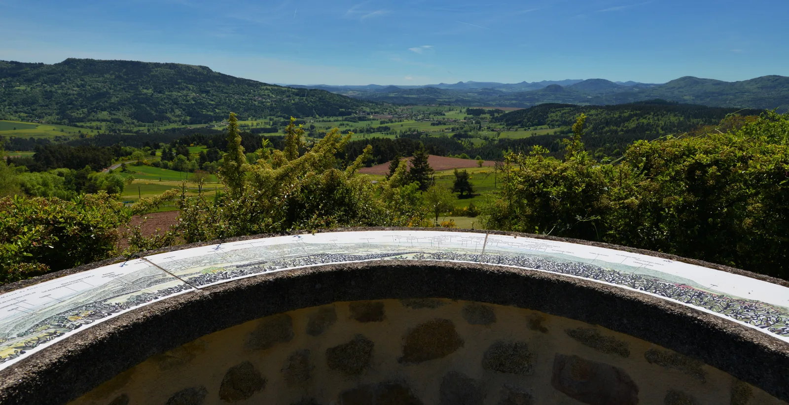
This small loop between forests and pastures is ideal for families. The orientation table of Solignac-sous-Roche offers magnificent views of the Mont de la Madeleine and the juices of Yssingelais and Meygal.
Portrait
The association of the Haute-Loire Hiking Committee has been asserting for 20 years its position in favor of the practice and development of hiking in Haute-Loire. Our business is divided into two major axes of development:
• The tourist and cultural development of the Haute-Loire through hiking
• The associative and sports development of hiking in Haute-Loire
Sustainable tourism
We promote hiking in Haute-Loire in compliance with the hiker's charter which aims to preserve nature and protected areas.
https://www.rando-hauteloire.fr/
https://www.chemin-rando-hauteloire.fr/?categories=T6&categories=T5
https://www.ffrandonnee.fr/Media/Default/Documents/randonner/charte-du-randonneur-ffrandonnee.pdf
Route details
Description
1- From the church, go down to the south by the lane and turn left.
2- At the crossroads, continue to the right (south) towards Emaillage and go down the road which leads away from the village. After the last houses, turn right along the wide path in the forest. Ford the Planchettes stream, continue through the undergrowth, then ford the tributary and climb the opposite side.
3- Take the path on the left then go straight to the edge of the forest.
Go down to the right to the bottom of the valley.
4- Turn left, cross the ford on the Planchettes stream and climb the path on the left.
5- As you approach Crespinhac, turn left then climb the path to the right. Follow the D 243 to the left for 160 m, take the path to the right, then climb the path to the left. At the fork, keep left. Cross the D 243, continue straight and find the crossroads to go.
2- On the right, reach the church.
UTM coordinates: 31 T 0578327 5011322